USDA Forest Service Gen. Tech. Rep. PSW-GTR-168-Web. 1998. 55
Evaluating the Impacts of Logging Activities on Erosion
and Suspended Sediment Transport in the Caspar Creek
Watersheds1
Jack Lewis2
Abstract: Suspended sediment has been sampled at both the North and South
Fork weirs of Caspar Creek in northwestern California since 1963, and at 13
tributary locations in the North Fork since 1986. The North Fork gaging station
(NFC) was used as a control to evaluate the effects of logging in the South Fork,
in the 1970Õs, on annual sediment loads. In the most conservative treatment of
the data, suspended loads increased by 212 percent over the total predicted for a
6-yr period commencing with the onset of logging. When the roles of the
watersheds were reversed and the same analysis repeated to evaluate harvesting
in the North Fork under California Forest Practice Rules in the 1990Õs, no
significant increase was found at NFC in either annual suspended or bed load.
With the advent of automatic pumping samplers, we were able to sample
sediment concentration much more frequently in the 1980Õs. This allowed storm
event loads from control watersheds in the North Fork to be used in a new
regression analysis for NFC. According to this more sensitive analysis, for the 7-
yr period commencing with the onset of logging, the sum of the suspended storm
loads at NFC was 89 percent higher than that predicted for the undisturbed
condition. The much greater increase after logging in the South Fork is too great
to be explained by differences in sampling methods and in water years, and
appears to be the result of differences in road alignment, yarding methods, and
stream protection zones.
Similar analyses of storm event loads for each of the treated subwatersheds
in the North Fork suggested increased suspended loads in all but one of the
tributaries, but effects were relatively small or absent at the main stem locations.
Of watersheds with less than 50 percent cut, only one showed a highly significant
increase. The greater increase in sediment at NFC, compared to other main-stem
stations, is largely explained by a 3,600-m3 landslide that occurred in 1995 in a
subwatershed that drains into the main stem just above NFC. Differences among
tributary responses can be explained in terms of channel conditions.
Analysis of an aggregated model simultaneously fit to all of the data shows
that sediment load increases are correlated with flow increases after logging.
Field evidence suggests that the increased flows, accompanied by soil disruption
and intense burning, accelerated erosion of unbuffered stream banks and
channel headward expansion. Windthrow along buffered streams also appears
to be important as a source of both woody debris and sediment. All roads in the
North Fork are located on upper slopes and do not appear to be a significant
source of sediment reaching the channels.
The aggregated model permitted evaluation of certain types of cumulative
effects. Effects of multiple disturbances on suspended loads were approximately
additive and, with one exception, downstream changes were no greater than
would have been expected from the proportion of area disturbed. A tendency for
main-stem channels to yield higher unit-area suspended loads was also detected,
but after logging this was no longer the case in the North Fork of Caspar Creek.
Soil erosion and mass movement play major roles in shaping the
landscapes that surround us. These processes complement those
that build mountains and soils, resulting in landforms such as
valleys, ridges, stream channels, and flood plains. Human activities
that change the balances between these processes can have
consequences that are detrimental to humans and the ecosystems
we depend on. Human activities often lead to an acceleration of soil
movement, net soil losses from hillslopes, and increases in sediment
transport and deposition in stream channels. When soil erosion
and mass movement directly damage roads, bridges, and buildings,
the costs are immediate and obvious. Direct effects on ecosystem
function and site productivity are also serious issues in many areas.
Indirect impacts on downstream water quality and stream channel
morphology, however, are often of greater concern.
Sediment-laden water supplies reduce the capacity of storage
reservoirs and may require additional treatment to render the water
drinkable. Sediment in irrigation water shortens the life of pumps
and reduces soil infiltration capacity. Water quality is also an
important issue for recreational water users and tourism.
Impacts of water quality on fish and aquatic organisms have
motivated much of the research being presented at this conference.
High sediment concentrations can damage the gills of salmonids
and macroinvertebrates (Bozek and Young 1994, Newcombe and
MacDonald 1991). High turbidity can impair the ability of fish to
locate food (Gregory and Northcote 1993) and can reduce the depth
at which photosynthesis can take place. However, suspended
sediment is not always detrimental to fish, and indexes based on
duration and concentration are unrealistically simplistic (Gregory
and others 1993). Turbidity, can, for example, provide cover from
predators (Gregory 1993).
If stream channels cannot transport all the sediment delivered
from hillslopes, they will aggrade, resulting in increased risks for
overbank flooding and bank erosion. It was this sort of risk,
threatening a redwood grove containing the worldÕs tallest tree,
that motivated the expansion of Redwood National Park in 1978
(U.S. Department of Interior 1981). Accelerated delivery of
sediment to streams can result in the filling of pools (Lisle and
Hilton 1992), and channel widening and shallowing. Hence, fish
rearing habitat may be lost, and stream temperatures often increase.
Excessive filling in spawning areas can block the emergence of fry
and bury substrates that support prey organisms. Settling and
infiltration of fine sediments into spawning gravels reduces the
transport of oxygen to incubating eggs (Lisle 1989) and inhibits the
removal of waste products that accumulate as embryos develop
(Meehan 1974). If aggradation is sufficient to locally eliminate
1 An abbreviated version of this paper was presented at the Conference on Coastal
Watersheds: The Caspar Creek Story, May 6, 1998, Ukiah, California.
2 Mathematical Statistician, Pacific Southwest Research Station, USDA Forest Service,
1700 Bayview Drive, Arcata, CA 95521.
Coastal Watersheds: The Caspar Creek Story Evaluating Impacts of Logging Activities in Caspar Creek Watersheds Lewis
56 USDA Forest Service Gen. Tech. Rep. PSW-GTR-168-Web. 1998.
surface flows during the dry season, fish can lose access to good
upstream habitat or become trapped in inhospitable environments.
How Do Harvest Practices Affect
Sediment Movement?
Figure 1 displays some of the mechanisms linking harvest activities
with instream sediment transport. It is impossible to show all the
potential interactions in only two dimensions, but the figure does hint
at the complexity of controls on sediment movement. Timber harvest
activities can accelerate erosion primarily through felling, yarding,
skidding, building and using roads and landings, and burning.
Felling
Removing trees reduces evapotranspiration and rainfall interception,
thus resulting in wetter soils (Keppeler and others 1994, Ziemer
1968). Loss of root strength and wetter soils can decrease slope
stability (OÕLoughlin and Ziemer 1982, Ziemer 1981). Trees near
clearcut edges face increased wind exposure and become more
susceptible to blowdown (Reid and Hilton, these proceedings),
disrupting soils if trees become uprooted. Addition of woody debris
to channels can cause scouring of the banks and channel, but also can
reduce sediment transport by increasing channel roughness and
trapping sediment (Lisle and Napolitano, these proceedings). The
effects of felling upon erosion can be altered by controlling the
quantity and the spatial and temporal patterns of cutting.
Yarding and Skidding
Heavy equipment compacts soils, decreasing infiltration and
percolation rates and increasing surface water. If vegetation and
duff are removed, the underlying soils become vulnerable to surface
erosion. The pattern of yarding and skidding can alter drainage
paths and redirect water onto areas that may be more likely to erode
than naturally evolved channels. Damage from yarding and
skidding is controlled primarily by the type of equipment, the care
exercised by the equipment operator, timing of operations, landing
location, and yarding direction.
Roads and Landings
Roads and landings have similar, but usually more pronounced,
impacts as yarding and skidding, and their presence can greatly
increase landslide risk. Compaction of the road bed can impede
subsurface drainage from upslope areas, resulting in increased pore
water pressures (Keppeler and Brown, these proceedings). Road
cuts and fills are vulnerable to accelerated runoff and surface
erosion, and are particularly vulnerable to slumping, especially on
steep slopes or if the fill or sidecast material has not been properly
compacted. Although roads and landings may be only a small part
of the total forest area, they are responsible for a disproportionate
amount of the total erosion (McCashion and Rice 1983, Swanson
and Dyrness 1975), often more than half. The erosional impact of
roads and landings can be managed through road alignment, design
and construction, drainage systems, type and timing of traffic, and
maintenance.
Burning
Burning can increase erodibility by creating bare ground, and hot
burns can delay revegetation by killing sprouting vegetation. In
some cases, burning can accelerate revegetation by releasing or
scarifying seeds and preparing a seed bed. Burning in areas with
sandy soils can create water-repellent soils and increase surface
runoff (DeBano 1979). The effect of burning on erosion depends
primarily on the temperature of the burn, soil cover, and soil and
vegetation types. Soil moisture, wind, air temperature, humidity,
slope steepness, and fuel abundance and distribution are the major
factors affecting burn temperatures.
Site Factors
Some sites are particularly vulnerable to mass wasting, and these
sites, while occupying a small part of the landscape, have been
found to be responsible for a large proportion of the total erosion in
Felling Yarding Burning
Skidding
Altered
Infiltration-
Exfiltration
Altered
Drainage
Patterns
Disturbed
Banks
Reduced
Transpiration
& Interception
Loss of
Root
Strength
Blowdown
and
Debris
Bare
Ground
Roads
Landings
Soil
Compaction
Unstable
Fills
Cut Banks
Over-
Steepened
Landslides
Channel & Bank
Morphology
Water Quantity
and Movement
Slope Stability
and Erodibility
Bank
Erosion
Hillslope
Sediment
Storage
Sediment
Delivery to
Channels
Fluvial
Sediment
Transport
Storage in
Channels
Storage in
Weir Pond
Transport to
Ocean
Surface
Erosion
Debris
Torrents
Figure 1—Conceptual diagram showing the major pathways through which
logging activities influence fluvial sediment transport.
Coastal Watersheds: The Caspar Creek Story Evaluating Impacts of Logging Activities in Caspar Creek Watersheds Lewis
USDA Forest Service Gen. Tech. Rep. PSW-GTR-168-Web. 1998. 57
northwestern California (Dodge and others 1976, Rice and
Datzman 1981). In the Critical Sites Erosion Study, an evaluation of
157 mass failure sites (>153 m3) and 326 randomly selected control
sites from logged areas in northwestern California, Durgin and
others (1989) concluded that management and site factors played
an equal role in road failures. In contrast, management factors were
secondary to site factors on hillslopes. The primary site factors
associated with mass failures were steep slopes, noncohesive soils
and fill materials, and incompetent underlying regolith. Most
failures were associated with the concentration of subsurface water,
as evidenced by perennial seeps, poorly drained soils, phreatic
vegetation, and locations in swales, inner gorges, and lower slope
positions. Previous slope failures were also evident at many of the
sites. The primary management factors associated with mass
failures were steep or overloaded fill slopes, steep cut banks, and
inadequate maintenance of roads and drainage systems. A field
procedure for estimating the probability of mass failure was also
developed (Lewis and Rice 1990, Rice and Lewis 1991) from the
Critical Sites Erosion Study.
Connecting Forest Practices with Water Quality
It is often difficult to identify the causes of erosion. Factors such as
increased soil water or reduced root strength are not directly
observable. Landslides are normal, stochastic, geomorphic events
in many undisturbed areas. Therefore, it may be impossible to show
that a landslide in a logged area would not have occurred had the
area been treated differently.
There is usually a great deal of uncertainty in determining when
and how much sediment from an erosion feature was delivered to a
stream channel. And it is even more difficult to determine the origin
of suspended sediment that has been measured at a gaging station.
Hence, many studies are correlative and rely on statistics to
identify relations between disturbance and water quality. In
environmental research, it is difficult to execute an experimental
design that permits wide inference. The best designs require
randomly assigning the treatments of interest to a large number of
similar experimental units. The random assignment reduces the
likelihood of associations between treatments and characteristics
that might affect the response of some subset of experimental units.
When studying a highly variable response such as sediment
transport, large sample sizes are needed to detect changes even
when the changes are substantial.
When the experimental unit is a watershed, it is usually
impractical to randomly assign treatments or monitor a large number
of watersheds. Instead, we use watersheds with similar physical
characteristics and subject to similar environmental influences, and
we repeat measurements before and after treatments are applied,
maintaining at least one watershed as an untreated control
throughout the study. If the relationship between measurements in
the treated and control watersheds changes after treatment, then we
can reason that the change is probably due to the treatment, unless
some chance occurrence (unrelated to the treatments) affected only
one of the watersheds. In reality, we have little control over such
chance occurrences. For example, there is no guarantee that rainfall
intensities will be uniform over the entire study area.
Such a paired-watershed design can provide a basis for
concluding whether a change occurred (Chow 1960, Wilson 1978)
and can be used to estimate the magnitude of changes. If chance
occurrences can be eliminated, effects can be attributed to the
overall treatment. If multiple watersheds are included in the design,
it may be useful to relate the magnitude of response to disturbances
such as proportion of area logged, burned, compacted by tractors,
etc. But, without additional evidence, nothing can be concluded
about specific causative mechanisms. Conclusions should be
consistent with the statistical evidence, but cause and effect must be
inferred non-statistically, by relating the results to concurrent
studies of other responses and physical processes, field
observations, and similar observations made elsewhere by others.
Study Area
The Caspar Creek Experimental Watersheds are located about 7 km
from the Pacific Ocean in the Jackson Demonstration State Forest,
Mendocino County, California (Preface, fig. 1, these proceedings).
Until the 1970Õs, both the 424-ha South Fork and 473-ha North Fork
watersheds were covered by second-growth redwood forests,
originally logged between 1860 and 1904. Both watersheds are
underlain by sandstones and shales of the Franciscan assemblage.
Rainfall averages about 1,200 mm yr-1, 90 percent of which falls during
October through April, and snow is rare. The location, topography,
soils, climate, vegetation, and land use history are described in detail
by Henry (these proceedings). The geology and geomorphology are
described by Cafferata and Spittler (these proceedings).
Methods
South Fork Treatment
The South Fork of Caspar Creek was roaded in the summer of 1967
and selectively logged in 1971-1973, before Forest Practice Rules
were mandated in California by the ZÕBerg Nejedly Forest Practice
Act of 1973. About 65 percent of the stand volume was removed. In
contrast with later logging in the North Fork, 75 percent of the
roads in the South Fork were located within 60 m of a stream, all
yarding was done by tractor, ground disturbance amounted to 15
percent of the area, and there were no equipment exclusion zones.
Details are provided by Henry (these proceedings) and by Rice and
others (1979). The North Fork was used as a control watershed to
evaluate the effects of logging in the South Fork until the North Fork
phase of the study was begun in 1985.
North Fork Treatments
The subwatershed containing units Y and Z (Preface, fig. 2, these
proceedings) of the North Fork was logged between December 1985
and April 1986. At the time, this area was thought to have different
soils than the remainder of the North Fork, so it was omitted from
the study plan that specified logging would begin in 1989. The
remainder of the North Fork logging took place between May 1989
and January 1992. Three subwatersheds (HEN, IVE, and MUN)
were left uncut throughout the study for use as controls. Henry
Coastal Watersheds: The Caspar Creek Story Evaluating Impacts of Logging Activities in Caspar Creek Watersheds Lewis
58 USDA Forest Service Gen. Tech. Rep. PSW-GTR-168-Web. 1998.
(these proceedings) summarizes the logging sequence. Briefly, 48
percent of the North Fork (including units Y and Z) was clearcut, 80
percent of this by cable yarding. Tractor yarding was restricted to
upper slopes, as were haul roads, spur roads, and landings. Ground
disturbance from new roads, landings, skid trails, and firelines in
the North Fork amounted to 3.2 percent of the total area. Streams
bearing fish or aquatic habitat were buffered by selectively logged
zones 23-60 m in slope width, and heavy equipment was excluded
from these areas.
Suspended Sediment and Turbidity Measurements
Accurate suspended sediment load estimation in small raindominated
watersheds like Caspar Creek depends upon frequent
sampling when sediment transport is high. Sediment
concentrations are highly variable and inconsistently or poorly
correlated with water discharge (Colby 1956, Rieger and Olive
1984). Since the 1960Õs, manual sampling methods have been
standardized by the U.S. Geological Survey. However, adequate
records are rare because it is inconvenient to sample at all hours of
the night and weekends. Errors of 50-100 percent are probably
typical when sampling is based on convenience (Thomas 1988,
Walling and Webb 1988).
In the South Fork phase of the study from 1963 to 1975,
sediment sampling was semi-automated by rigging bottles in the
weir ponds at different heights. These single-stage samplers (Inter-
Agency Committee on Water Resources 1961) filled at known stages
during the rising limb of the hydrograph, but the much lengthier
falling limb was sampled using DH-48 depth-integrating hand
samplers (Federal Inter-Agency River Basin Committee 1952) and,
in most cases, was not well-represented. In 1974 and 1975, the
number of DH-48 samples was increased greatly and, in 1976, the
single-stage samplers were replaced by pumping samplers. The
average number of samples collected was 58 per station per year in
1963-1973 and 196 per station per year in 1974-1985.
During the North Fork phase of the study, in water years 1986-
1995, the North Fork weir (NFC), the South Fork weir (SFC) and 13
other locations in the North Fork were gaged for suspended
sediment and flow (Preface, fig. 2, these proceedings). Pumping
samplers were controlled using programmable calculators and
circuit boards that based sampling decisions on real-time stage
information (Eads and Boolootian 1985). Sampling times were
randomly selected using an algorithm that increased the average
sampling rate at higher discharges (Thomas 1985, Thomas 1989).
Probability sampling permitted us to estimate sediment loads and
the variance of those estimates without bias. We also sent crews out
to the watershed 24 hours a day during storm events to replace
bottles, check equipment, and take occasional, simultaneous,
manual and pumped samples. The average number of samples
collected in 1986-1995 was 139 per station per year.
In water year 1996, we began using battery-operated turbidity
sensors and programmable data loggers to control the pumping
samplers at eight gaging stations, and monitoring was discontinued
at the remaining seven stations. Although turbidity is sensitive to
particle size, composition, and suspended organics, it is much better
correlated with suspended sediment concentration than is water
discharge. A continuous record of turbidity provides temporal
detail about sediment transport that is currently impractical to
obtain by any other means, while reducing the number of pumped
samples needed to reliably estimate sediment loads (Lewis 1996).
However, because these turbidity sensors remain in the stream
during measurement periods, they are prone to fouling with debris,
aquatic organisms, and sediment, so it was still necessary to
frequently check the data and clean the optics. The average number
of samples collected in 1996 was 49 per station per year.
Suspended Sediment Load Estimation
The basic data unit for analysis was the suspended sediment load
measured at a gaging station during a storm event or hydrologic
year. Annual loads were estimated only for NFC and SFC and, to
facilitate comparisons with the South Fork study, these were
computed by Dr. Raymond Rice using the same methods as in an
earlier analysis (Rice and others 1979). This involved fitting
sediment rating curves by eye, multiplying the volume of flow in
each of 19 discharge classes by the fitted suspended sediment
concentration at the midpoint of each class, and summing. As
technology has improved over the years, our methods of sample
selection have improved. Thus, although the computational scheme
for estimating annual loads was repeated in both studies, the
sampling bias has changed, and caution must be used when
comparing the sediment loads from the two studies.
For estimating storm loads in 1986-1995, the concentrations
between samples were computed using interpolations relating
concentration to either time or stage. Concentration was first
adjusted to obtain cross-sectional mean concentrations using
regressions based on the paired manual and pumped samples. For
those events in which probability sampling was employed, loads
and variances were also estimated using appropriate sampling
formulae (Thomas 1985, Thomas 1989). However, Monte Carlo
simulations (Lewis and others 1998), showed that the interpolation
methods were more accurate (lower mean square error). Based on
the variance estimates and simulations, the median error of our
estimates for storm events was less than 10 percent.
For estimating storm loads in 1996, concentration was
predicted using linear regressions, fit to each storm, of
concentration on turbidity. This method produced load estimates
with the same or better accuracy than before, while substantially
reducing the number of samples collected (Lewis 1996). Time or
stage interpolation was employed for periods when turbidity
information was unavailable.
Total Sediment Load Estimation
The bedload and roughly 40 percent of the suspended load settle in
the weir ponds, and thus are not measured at NFC and SFC. The
weir ponds are surveyed annually to estimate total sediment load
(suspended plus bedload) by summing the pond accumulations
and sediment loads measured at the weirs. Pond volumes are
converted to mass based on a density of 1,185 kg m-3. In some of the
Coastal Watersheds: The Caspar Creek Story Evaluating Impacts of Logging Activities in Caspar Creek Watersheds Lewis
USDA Forest Service Gen. Tech. Rep. PSW-GTR-168-Web. 1998. 59
drier years of record (1972, 1976, 1987, 1991, 1992, and 1994),
negative pond accumulations have been recorded. These values may
result from settling or measurement errors, but some of the values
were too large in magnitude to have resulted from settling alone, so
negative values were converted to zero before adding pond
accumulations to suspended loads. In the results below, only those
that explicitly refer to total sediment load include any sediment
that settled in the weir ponds.
Erosion Measurements
Starting in 1986, a database of failures exceeding 7.6 m3 (10 yd3)
was maintained in the North Fork. This inventory was updated
from channel surveys at least once a year. Road and hillslope failures
were recorded when they were observed, but an exhaustive search
was not conducted. Volume estimates were made using tape
measurements of void spaces left by the failures, except in a few
cases where more accurate survey methods were used. For each
failure, crews recorded void volume, volume remaining at the site
(starting in 1993), location, distance to nearest channel, and any
association with windthrow, roads, or logging disturbance.
Discrete failures such as those included in the failure database
are relatively easy to find and measure. In contrast, surface erosion
is difficult to find and sample because it is often dispersed or
inconspicuous. To obtain an estimate of dispersed erosion sources,
erosion plots were randomly selected and measured in each
subwatershed. Rills, gullies, sheet erosion, and mass movements
were measured on independent samples of road plots and 0.08-ha
circular hillslope plots. Road plots consisted of 1.5-m wide bands
oriented perpendicular to the right-of-way, plus any erosion at the
nearest downslope diversion structure (water bar, rolling dip, or
culvert). A total of 175 hillslope plots and 129 road plots were
measured. These data were collected for a sediment delivery study
and are summarized in a separate report by Rice (1996).
Analyses and Results
Annual Sediment Loads after Logging
the South Fork
Linear regressions between the logarithms of the annual suspended
sediment loads at the two weirs were used to characterize (1) the
relationship of SFC to NFC before the 1971-1973 logging in the
South Fork and (2) the relationship of NFC to SFC before the 1989-
1992 logging in the North Fork.
The calibration water years used in the South Fork analysis
were 1963-1967, before road construction. The sediment load in
1968, after road construction, did not conform to the pretreatment
regression (fig. 2a), but the data from the years 1969-1971 were not
significantly different from the 1963-1967 data (Chow test, p = 0.10).
In 1968, the increase in suspended load was 1,475 kg ha-1, an
increase of 335 percent over that predicted for an undisturbed
condition. The years 1972-1978 (during and after logging) again
differed from the pretreatment regression. Water year 1977 was
missing owing to instrument malfunction. By 1979, the suspended
sediment load at SFC had returned to pretreatment levels. The
increased suspended load after logging amounted to 2,510 kg ha-1yr-1,
or an increase of 212 percent over that predicted for the 6-yr period
by the regression. (Predictions were corrected for bias when
backtransforming from logarithms to original units.) The greatest
absolute increases occurred in the years 1973 and 1974, followed by
1975 (fig. 2b).
A pair of large landslides (one in each watershed) occurred
during hydrologic year 1974, complicating the analysis by Rice and
others (1979), where the North ForkÕs sediment load was adjusted
downward because most of the North Fork slide reached the stream,
while most of the South Fork slide did not. However, that year did
not appear anomalous in my analysis, and I did not make any
adjustments. But the unadjusted prediction requires extrapolation
of the regression line well beyond the range of the pretreatment
Annual load at NFC (kg ha-1)
Annual load at SFC (kg ha-1)
50 100 500 1000 5000
500 5000
63
64
65
66
67
68 69
70
71
72
73
74
75
76
78
79
80
81
82
83
84
85
Pretreatment
Water year
Departure (kg ha-1)
65 70 75 80
0 1000 3000 5000
Pretreatment
Roaded
Logged
a) b)
Figure 2—(a) Relation between estimated annual suspended sediment loads at South Fork Caspar Creek (SFC)
and North Fork Caspar Creek (NFC) from 1963 to 1985. Pretreatment regression line is fit to the water years
before roading and logging activity in the South Fork. (b) Time series of departures from the regression line.
Coastal Watersheds: The Caspar Creek Story Evaluating Impacts of Logging Activities in Caspar Creek Watersheds Lewis
60 USDA Forest Service Gen. Tech. Rep. PSW-GTR-168-Web. 1998.
data, so it is still suspect. If the adjustment of Rice and others (1979)
is applied in my analysis, the revised increase in suspended
sediment load is 2,835 kg ha-1yr-1, or an increase of 331 percent over
that predicted for the 6-yr period. The adjusted figure reported for
the 5-yr period (1972-1976) by Rice and others was 3,245 kg ha-1yr-1,
an increase of 354 percent over that predicted.
Although no statistically significant logging effect on pond
accumulation was detected, regression analysis using total sediment
load (including data from 1974) revealed a similar pattern of
impacts as that of the suspended load. The increased total sediment
load after logging of the South Fork amounted to 2,763 kg ha-1yr-1,
or an increase of 184 percent over that predicted for the 6-yr period
by the regression.
Annual Sediment Loads after Logging
the North Fork
The calibration period used in the North Fork analysis includes
1979-1985, the years after the South ForkÕs apparent recovery, as
well as 1963-1967. The years 1986-1989 were not included in the
calibration period because the Y and Z units were logged in 1985
and 1986. Applying the Chow test, neither 1986-1989 (p = 0.43) nor
1990-1995 (p = 0.53) was found to differ significantly from the
suspended sediment calibration regression (fig. 3a ). The
(nonsignificant) departures from the regression predictions
averaged 118 kg ha-1yr-1, amounting to just 28 percent above that
predicted for the 6-yr period by the regression (fig. 3b). No effect
was detected for pond accumulation by itself or total sediment load.
For total sediment load, the (nonsignificant) departures from the
regression predictions averaged -80 kg ha-1yr-1, or 8 percent below
that predicted for the 6-yr period by the regression.
The absolute numbers reported in the above and earlier analyses
of the South Fork logging (Rice and others 1979) must be viewed with
reservation. The suspended load estimates were based on hand-drawn
sediment rating curves describing the relation between the
concentration of samples collected in a given year to the discharge
levels at which they were collected. In several years, samples were not
available from all discharge classes, so it was necessary to extrapolate
the relation between concentration and discharge to higher or lower
unrepresented classes. Also, a majority of the samples from the years
1963-1975 were collected using single-stage samplers that are filled
only during the rising limb of hydrographs. In most storm events we
have measured at Caspar Creek, the concentrations are markedly
higher on the rising limb of the hydrograph than for equivalent
discharges on the falling limb (e.g., fig. 4). Therefore, the fitted
concentrations were likely too high. A plot of estimated sediment
loads at NFC against annual water yield for the pre-logging years
(fig. 5) suggests that there may be a positive bias during the singlestage
years. The error associated with this method certainly varies
from year to year, depending on the numbers of single-stage and
manual samples and their distribution relative to the hydrographs.
However, the plot indicates that loads were overestimated by a factor
of between 2 and 3 in the range where most of the data occur. A
comparison of the annual loads for the years 1986-1995 with annual
sums of storm loads (the most accurate) shows very little bias,
indicating that bias in the early years resulted mainly from sampling
protocols rather than the computational method, which was the same
for all years in this analysis.
North Fork Analysis Using Unlogged
Subwatersheds as Controls
Because of improved and more intensive sampling methods, the
suspended sediment loads for storm events beginning in 1986 are
known far more accurately than the annual loads used in the NFC/
SFC contrasts presented above. Four unlogged control watersheds
were available (HEN, IVE, MUN, and SFC) for the analysis of storm
loads. Unfortunately, only one large storm was available before
logging. That storm was missed at SFC because of pumping sampler
problems. Because of various technical difficulties, not all storms
Annual load at SFC (kg ha-1)
Annual load at NFC (kg ha-1)
50 100 500 1000
50 500
64 63
65
66
67
79
80
81
82
83
84
85
86
87
88
89
90
91
92
93
94
Pretreatment 95
Water year
Departure (kg ha-1)
65 70 75 80 85 90 95
-500 0 500 1000
Pretreatment
YZ logged
ARF logged
a) b)
Figure 3—(a) Relation between estimated annual suspended sediment loads at North Fork Caspar Creek (NFC)
and South Fork Caspar Creek (SFC) from 1963 to 1967 and 1979 to 1995, excluding years when sediment was
elevated following logging in the South Fork. Pretreatment regression line is fit to the water years before roading and
logging activity in the North Fork. (b) Time series of departures from the regression line.
Coastal Watersheds: The Caspar Creek Story Evaluating Impacts of Logging Activities in Caspar Creek Watersheds Lewis
USDA Forest Service Gen. Tech. Rep. PSW-GTR-168-Web. 1998. 61
were adequately sampled at each station. However, the sample size
for analyses was increased by using the mean of available data from
the three tributary control watersheds, HEN, IVE, and MUN, in
each storm. (SFC was eliminated because it had lower pretreatment
correlations with the North Fork stations.) This mean (denoted
HIM) provided a pretreatment sample size of 17 storms. The more
accurate sediment loads, better controls, and larger sample size
gave this analysis greater reliability and increased power to detect
changes than the annual load analysis.
A weakness in analyses of logging effects at NFC was the need
to use 1986-1989 as a calibration period even though 12 percent of
the area had been clearcut. The clearcut area might be expected to
somewhat diminish the size of the effect detected. The occurrence
of only one large storm event before logging is mitigated by the fact
that it was thoroughly sampled at both NFC and the three controls.
An average of 59 sample bottles were collected at each of the four
stations, and all the standard errors were less than 10 percent of the
estimated loads, so there is little doubt about this pointÕs validity.
Figure 6 shows regression lines fit to the suspended storm
loads at NFC versus those at HIM before and after logging began in
the spring of 1989. There was clearly an increase in suspended loads
in small storms after logging began. In large storms there also seems
to be an effect, although some post-treatment points are very close
to the one large pretreatment point. The Chow test for a change
after logging was significant with p = 0.006. The increases over
predicted load, summed over all storms in the post-treatment
period, average 188 kg ha-1yr-1, and amount to an 89 percent increase
over background. The storms in this analysis represent 41 percent
of the 1990-1996 streamflow at NFC, but carried approximately 90
percent of the suspended sediment that passed over the weir (based
on figure 2 of Rice and others 1979).
A 3,600-m3 landslide that occurred in the Z cut unit (Preface,
fig. 2, these proceedings) increased sediment loads at the NFC
gaging station starting in January 1995. NFC was the only gage
downstream from this slide. The sum of suspended loads from
storms preceding the landslide was 47 percent higher (64 kg ha-1yr-1)
than predicted. The sum of suspended loads from storms after the
landslide was 164 percent higher (150 kg ha-1yr-1) than predicted.
Individual Regressions for Subwatersheds
Similar analyses for each of the subwatersheds in the North Fork
(fig. 7 and table 1) indicate increased suspended sediment loads in
all the clearcut tributaries except KJE. Sediment loads in the KJE
watershed appear to have decreased after logging. The only partly
clearcut watershed on a tributary (DOL) also showed highly
significant increases in sediment loads. The upper main-stem
stations (JOH and LAN) showed no effect after logging, and the
lower main-stem stations (FLY and ARF) experienced increases only
in smaller storms. Summing suspended sediment over all storms,
the four main-stem stations all showed little or no change (table 1).
Discharge (m3 s-1)
SSC (mg L-1)
1.0 1.5 2.0 2.5 3.0
100 200 300 400
rising discharge
falling discharge
Figure 4—Storm event at lower main-stem station ARF, January 13-14, 1995,
with water discharge and laboratory sediment concentrations (SSC) at 10-
minute intervals.
+
+
+
++
+
+
+++
+ + +
Annual streamflow (m3 ha-1)
Estimated load (kg ha-1)
3000 4000 6000
50 500 5000
single-stage years
pumping sampler years
9000 12000
Figure 5—Relations between estimated annual suspended sediment loads
and annual streamflow at North Fork Caspar Creek (NFC) prior to logging.
Illustrates that load estimates based on sediment rating curves depend
systematically on sampling protocols.
1 5 10 50 100
5 10 50 100 500
Sediment load at HIM (kg ha-1)
Sediment load at NFC (kg ha-1)
pre-treatment
post-treatment
Figure 6—Relation between storm suspended sediment loads at North Fork
Caspar Creek (NFC) and HIM control (mean suspended load of unlogged
tributaries HEN, IVE, and MUN) from 1986 to 1995. Pretreatment regression
line is based on storms in water years 1986-1989, before the major logging
activity began.
Coastal Watersheds: The Caspar Creek Story Evaluating Impacts of Logging Activities in Caspar Creek Watersheds Lewis
62 USDA Forest Service Gen. Tech. Rep. PSW-GTR-168-Web. 1998.
BAN KJE GIB CAR EAG
1 10 100 1000
JOH
1 10 100
DOL LAN
1 10 100
FLY ARF
1 10 100
Suspended sediment load at HIM (kg ha-1)
Suspended load at logged station (kg ha-1)
pre-logging post-logging
1 10 100 1 10 100
1 10 100 1000
Figure 7—Relations between storm suspended sediment loads at logged subwatersheds in the
North Fork and HIM control (mean suspended load of unlogged tributaries HEN, IVE, and MUN)
from 1986 to 1995. Pre-logging regression lines are based on pretreatment years that are specific
to each subwatershed. Post-logging relations are not assumed to be linear, hence were fitted by
locally weighted regression (Cleveland 1993).
Treated
watershed
Number of
years
Observed
(kg ha -1 yr -1 )
Predicted
(kg ha -1 yr -1 )
Change
(kg ha -1 yr -1 )
Change
(%)
ARF 4 505 591 -86 -15
BAN 4 85 28 57 203
CAR 5 240 108 132 123
DOL 5 1130 306 824 269
EAG 5 710 210 500 238
FLY 5 536 555 -19 -3
GIB 4 358 119 239 200
JOH 5 667 865 -198 -23
KJE 5 821 1371 -551 -40
LAN 5 420 400 20 5
NFC 6 465 246 219 89
Table 1ÑSummary of changes in suspended sediment load (summed over storms) after logging in North Fork
subwatersheds. Predicted loads are computed from pre-treatment linear regressions between the logarithms of the storm
sediment load in the treated watershed and the mean of the storm sediment loads at the control watersheds HEN, IVE,
and MUN. Predictions were corrected for bias when back-transforming from logarithmic units. The number of years in
the post-logging period varies from 4 to 6, depending upon when the watershed was logged and whether or not monitoring
was discontinued in water year 1996.
Coastal Watersheds: The Caspar Creek Story Evaluating Impacts of Logging Activities in Caspar Creek Watersheds Lewis
USDA Forest Service Gen. Tech. Rep. PSW-GTR-168-Web. 1998. 63
Aggregated Regression Model for Subwatersheds
To evaluate the relationships between suspended sediment load
increases and possible explanatory variables, an aggregated
regression model was fit simultaneously to all the subwatershed
storms. The model utilized 367 estimated loads from 51 storms
when HIM was used as the control or 333 estimated loads from 43
storms when HI (the mean of HEN and IVE) was used. Two
regression coefficients were fitted for each watershed. A number of
disturbance measures were considered (table 2), as well as an area
term designed to describe cumulative effects, and a term explaining
sediment increases in terms of flow increases. A great deal of effort
went into developing a model that would permit valid tests of
hypotheses concerning cumulative watershed effects. Therefore, the
response model is coupled with a covariance model that describes
variability in terms of watershed area and correlation among
subwatershed responses as a function of distance between
watersheds. These models were solved using the method of
maximum likelihood and will be described in detail in a separate
publication (Lewis and others 1998).
Departures from sediment loads predicted by the aggregated
model for undisturbed watersheds were modest. The median
increase in storm sediment load was 107 percent in clearcuts and 64
percent in partly clearcut watersheds. The median annual increase
was 109 percent (58 kg ha-1yr-1) from clearcut watersheds and 73
percent (46 kg ha-1yr-1) from partly clearcut watersheds. The
absolute flux values are underestimated somewhat because they
include only sediment measured in storms, and no effort has been
made to adjust for missing data. However, the major storms have
been included, and virtually all of the sediment is transported
during storms. Uncertainty due to year-to-year variability is
certainly a much greater source of error.
The most important explanatory variable identified by the
model was increased volume of streamflow during storms. Storm
flow predictions (Ziemer, these proceedings) were based on an
aggregated model analogous to that used for predicting sediment
loads. The ratio of storm sediment produced to that predicted for
an unlogged condition was positively correlated to the ratio of storm
flow produced to that predicted for an unlogged condition (fig. 8).
This result is not unexpected because, after logging, increased storm
flows in the treated watersheds provide additional energy to deliver
and transport available sediment and perhaps to generate
additional sediment through channel and bank erosion.
Whereas individual watersheds show trends indicating
increasing or decreasing sediment loads, there is no overall pattern
of recovery apparent in a trend analysis of the residuals from the
model (fig. 9a). This is in contrast with the parallel model for storm
flow volume (fig. 9b), and suggests that some of the sediment
increases are unrelated to flow increases.
Other variables found to be significant were road cut and fill
area, and, in models using the HI control, the length of unbuffered
stream channel, particularly in burned areas. Under California
Forest Practice Rules in effect during the North Fork logging, buffers
were not required for stream channels that do not include aquatic
life and are not used by fish within 1,000 feet downstream except in
confluent waters. As discussed earlier, one must be cautious about
drawing conclusions about cause and effect when treatments are
not randomly assigned to experimental units and replication is
limited. Increases in sediment load in one or two watersheds can
create associations with any variable that happens to have higher
values in those watersheds, whether or not those variables are
physically related to the increases. In this study, the contrast in
response is primarily between watershed KJE, where sediment loads
decreased, versus watersheds BAN, CAR, DOL, EAG, and GIB.
Watershed KJE was unburned and also had the smallest amount of
unbuffered stream of all the cut units. Watersheds EAG and GIB
were burned and had the greatest amount of unbuffered stream in
burned areas. Watershed EAG experienced the largest sediment
increases and also had the greatest proportion of road cut and fill
area. Because EAG was not unusually high in road surface area, the
large road cut and fill area indicates that the roads in EAG are on
steeper hillslopes.
There is little field evidence of sediment delivery from roads in
Mean unit area suspended load from control watersheds
Excess storm flow volume relative to that of control watersheds
Time since logging completed
Timber removed per unit watershed area
Areas of various disturbances as proportion of watershed:
Cable, tractor yarding
Stream protection zones, thinned areas
Burning (low intensity, high intensity)
Road cuts, fills, running surfaces
Skid trail cuts, fills, operating surfaces
Landing cuts, fills, operating surfaces
Areas of above disturbances within 46 m (150 ft) of a stream channel
Length of impacted stream in above disturbances per unit watershed area
Length of cabled corridors per unit watershed area
Watershed area
Table 2ÑExplanatory variables considered in modeling storm sediment loads in North Fork
subwatersheds.
•
•
•
•
•
•
•
•
•
•
•
• •
•
•
•
• •
•
•
•
• •
•
•
•
•
•
•
•
•
•
•
•
•
•
• • • •
• •
•
•
•
•
•
• •
•
•
•
•
•
•
•
•
•
•
•
•
•
•
•
•
•
•
•
•
•
•
•
•
•
•
•
•
•
•
•
•
•
•
•
•
•
•
•
•
•
•
•
•
•
•
•
•
•
•
•
•
• •
•
•
•
•
• • •
•
•
•
•
•
•
•
•
• •
• • •
•
•
•
•
•
•
•
• •
•
•
•
•
•
• •
•
•
•
•
• •
•
•
•
•
•
• •
•
•
• •
•
• •
•
•
•
•
•
•
• •
•
•
• •
•
•
•
•
•
•
•
•
•
•
•
•
•
•
• ••
•
•
•
•
•
•
•
•
•
• •
•
•
••
•
Flow ratio (observed:predicted)
0.9
0.5
1
5
10
Sediment ratio (observed:predicted)
0.8 1.0 1.2 1.4 1.6 1.8 2.0 2.4
r = 0.64
Figure 8—Relation between post-logging ratios of observed to predicted
storm flow and suspended sediment load for all North Fork subwatersheds.
Predictions are for undisturbed watersheds based on aggregated regression
models using HI control (mean response of unlogged tributaries HEN and IVE).
Coastal Watersheds: The Caspar Creek Story Evaluating Impacts of Logging Activities in Caspar Creek Watersheds Lewis
64 USDA Forest Service Gen. Tech. Rep. PSW-GTR-168-Web. 1998.
the North Fork watershed. In the inventory of failures greater than
7.6 m3, only 8 of 96 failures, and 1,686 of 7,343 m3 of erosion were
related to roads. Nearly all of this road-related erosion was recorded
as remaining on-site, and none of the road-related failures occurred
in the EAG watershed. Based on the 129 random erosion plots (Rice
1996), the road erosion in EAG was 9.3 m3ha-1, compared to 34.5
m3ha-1 for KJE and 16.6 m3ha-1 for all roads in the North Fork. Thus
it seems that the appearance of road cuts and fills in the model
resulted from a spurious correlation.
On the other hand, channel reaches subjected to intense
broadcast burns did show increased erosion from the loss of woody
debris that stores sediment and enhances channel roughness
(Keppeler, electronic communication). And increased flows,
accompanied by soil disruption and burning in headwater swales,
may have accelerated channel headward expansion, and soil pipe
enlargements and collapses observed in watershed KJE (Ziemer
1992) and in EAG, DOL, and LAN.
Based on the 175 random erosion plots in harvest areas (Rice
1996), the average hillslope erosion rates in the burned watersheds
EAG and GIB were 153 m3ha-1 and 77 m3ha-1, respectively, the
highest of all the watersheds. The average rate for the unburned
clearcut watersheds BAN, CAR, and KJE was 37 m3ha-1. These figures
include estimates of sheet erosion, which is difficult to measure and
may be biased towards burned areas because it was easier to see the
ground where the slash had been burned (Keppeler, verbal
communication). About 72 percent of EAG and 82 percent of GIB
were judged to be thoroughly or intensely burned, and the
remainder was burned lightly or incompletely. It is unknown how
much of this hillslope erosion was delivered to stream channels, but
the proportion of watershed burned was not a useful explanatory
variable for suspended sediment transport.
The failure inventory identified windthrow as another fairly
important source of sediment. Of failures greater than 7.6 m3, 68
percent were from windthrow. While these amounted to only 18
percent of the failure volume measured, 91 percent of them were
within 15 m of a stream, and 49 percent were in or adjacent to a
stream channel. Because of the proximity of windthrows to streams,
sediment delivery from windthrow is expected to be
disproportionate to the erosion volume. Windthrows are also
important as contributors of woody debris to channels (Reid and
Hilton, these proceedings), and play a key role in pool formation
(Lisle and Napolitano, these proceedings). Because woody debris
traps sediment in transport, it is unknown whether the net effect of
windthrow on sediment transport was positive or negative.
Cumulative Effects
A full explanation of the rationale and methods of testing for
cumulative watershed effects is beyond the scope of this paper, and
final results on this topic will be reported by Lewis and others
(1998). Preliminary results will simply be stated here.
I have considered three types of information that the
aggregated model provides about the cumulative effects of logging
activity on suspended sediment loads:
1. Were the effects of multiple disturbances additive in
a given watershed?
2. Were downstream changes greater than would be
expected from the proportion of area disturbed?
3. Were sediment loads in the lower watershed elevated to
higher levels than in the tributaries?
The response being considered in all of these questions is the
suspended sediment load per unit watershed area for a given storm
event. Watershed area was used in the model to represent distance
downstream.
•
••• •
•
•
•
•
•
•
•
• •
•
•
•
•
•
•
• • •
•
•
•
•
•
•
•
•
•
••
•
•
• •
••
•
•
•
•
•
•
•
•
••
•
•
•
•
•
•
•
•
•
•
•
•
•
• •
••
•
•
•
•
• •
•
•
•
•
•
••
•
••
•
•
•
•
•
•
•
•• •
•
• •
•
••
• • • •
••
•
•
•
••
••
•
•
•
•
••
••
•
•
•
••
•
•
• •
• •
•
•
•
•
•
•
• •
•
•
•
•
•• • •
•
•
•
•
•
•
•
•
•
•
•
•
•
•
•
Time since harvesting (water years)
0 1 2 3 4 5
-1.0
-0.5
0.0
0.5
1.0
1.5
2.0
Sediment residual (log[kg ha-1])
a)
••
•
•••
•
•••
•
•
••••
•
••
•
•
• •
•
•
••
• •
••
•
•
•
•
•
•
•
• •
•
•
• •
•
• •
•
•
•
•
•• •
•
•
•
•
•
•
•
••
•
•• • •
•
•
•
•
•
•
•
•
•
•
•
•
•
••
••
•
•
•
•
•
•
•
• •
•
•
•
•
•
•
•
•
•
••
• •
•
•
•
•
•
••
•
• • •
• •
•
• •
••
•
•
•
•
• •
• •
•
•
•
•
••
•
•
•
•
•
•
•
•
• •
•
•
••
•
•
• •
••
• •
•
• •
•
• •
•
•
•
•
•
•
•
•
• •
•
•
•
•
•
•
•
•
••
•
•
•
• •
•
• • •
•
•
• •
•
•
•
•
•
•
••
•
•
•
•
•
•
••
•
•
• •
•
•
•
•
•
•
•
• •
•
•
••
•
••
•
•
•
•
•
•
•
•
• ••
Time since harvesting (water years)
1 2 3 4 5 6
-0.4
-0.2
0.0
0.2
0.4
Flow residual (log[m3 ha-1])
b)
Figure 9—Relation between post-logging residuals from aggregated models and time (difference in water years)
since harvesting. (a) model for storm suspended sediment loads, and (b) model for storm flow volumes. Curves
were fitted by locally weighted regression (Cleveland 1993).
Coastal Watersheds: The Caspar Creek Story Evaluating Impacts of Logging Activities in Caspar Creek Watersheds Lewis
USDA Forest Service Gen. Tech. Rep. PSW-GTR-168-Web. 1998. 65
The first question may be answered partly by looking at the
forms of the storm flow and sediment models. Analyses of the
residuals and covariance structures provide good evidence that the
models are appropriate for the data, including the use of a
logarithmic response variable. This implies a multiplicative effect
for predictors that enter linearly and a power function for predictors
that enter as logarithms. It turns out that the flow response to
logged area is multiplicative, and the sediment response to flow
increases is a power function. These effects, however, are
approximately additive within the range of data observed for
watersheds receiving flow from multiple cut units.
The second question was addressed by testing terms formed
from the product of disturbance and watershed area. If the
coefficient of this term were positive, it would imply that the effect
of a given disturbance proportion increases with watershed size. A
number of disturbance measures were considered, including road
cut and fill area and length of unbuffered stream channels. None of
the product terms were found to have coefficients significantly
greater than zero, indicating that suspended load increases were
not disproportionately large in larger watersheds. To the contrary,
the sum of the observed sediment loads at the four main-stem
stations were all within 25 percent of the sum of the loads predicted
for undisturbed watersheds (table 1). Apparently, much of the
sediment measured in the tributaries has been trapped behind
woody debris or otherwise stored in the channels, so that much of it
has not yet been measured downstream.
There is, however, one subwatershed where this second type of
cumulative effect may be occurring. Watershed DOL, only 36
percent cut, includes the 100 percent cut watershed EAG, yet the
sediment increases (269 percent at DOL versus 238 percent at EAG)
have been similar. The increases in DOL seem to be related to
channel conditions created in the historic logging (1900-1904) and,
possibly, to increased flows from recent logging. At the turn of the
century, the channel between the DOL and EAG gaging stations was
used as a Òcorduroy roadÓ for skidding logs by oxen. Greased logs
were half-buried in the ground at intervals equal to the step length
of the oxen (Napolitano 1996), and an abundance of sediment is
stored behind them today (Keppeler, electronic communication).
Energy available during high flows may be mobilizing sediment
stored behind these logs. In the lower reach, the channel has a low
width:depth ratio and is unable to dissipate energy by overflowing
its banks. The high banks in this reach would be particularly
vulnerable to increased peak flows, and have failed in a number of
places in the years since EAG was logged.
The third question was addressed by testing watershed area as
a linear term in the model. The coefficient of watershed area was
positive (p = 0.0023), implying that the response, suspended
sediment transport per unit watershed area, tends to increase
downstream in the absence of disturbance. This tendency (with the
exception of watershed KJE) is apparent in the pretreatment lines fit
by least squares (fig. 10a), and could be reflecting the greater
availability of fine sediment stored in these lower gradient channels.
The relevance to cumulative effects is that downstream locations
might reach water quality levels of concern with a smaller
proportion of watershed disturbance than upstream locations.
To the extent that larger watersheds reflect average disturbance
rates and therefore have smaller proportions of disturbance than the
smallest disturbed watersheds upstream, one might expect sediment
loads downstream to increase by less than those in the logged
tributaries, reducing the overall variability among watersheds. In
addition, as mentioned before, some of the sediment may be stored
for several years before reaching the lower stations. That is what we
observed in this studyÑthe post-treatment regression lines (fig. 10b)
were much more similar among watersheds than the pretreatment
lines, and the main-stem stations no longer transported the highest
sediment loads relative to watershed area.
Discussion
North Fork versus South Fork
My analysis of the South Fork logging data used a different model
than was used by Rice and others (1979). However, the estimated
increases in sediment loads were similar. For example, they
reported suspended load increases of 1,403 kg ha-1yr-1 in the year
after road construction and 3,254 kg ha-1yr-1 for the 5-yr period
after logging. For the same periods, I estimated increases of 1,475
and 2,877 kg ha-1yr-1. Reversing the roles of the two watersheds for
the later North Fork logging, the same analysis was unable to
detect an effect. However, analysis of storm event loads from 1986
to 1996, using smaller subwatersheds within the North Fork as
controls that had similar 19th-century logging histories as the
whole North Fork, indicated that storm loads at NFC had
increased by 188 kg ha-1yr-1. When comparing these figures, one
should consider the differences between the water years 1972-
1978 and 1990-1996, as well as differences in sampling
methodologies that could have biased the estimated sediment
loads. The mean annual unit area streamflow in the control (NFC)
was 63 percent higher in 1972-1978 than that in the control (SFC)
in 1990-1996. There is a surprisingly good relation between
annual excess sediment load (departures from the pre-treatment
regression) and water discharge in each of the studies (fig. 11). For
equivalent flows, excess sediment loads in the South Fork analysis
were six to seven times those in the North Fork analysis. It is
probable that the sampling methods in the 1960Õs and 1970Õs
resulted in overestimation of sediment loads in the South Fork
analysis by a factor of 2 or 3. Therefore, comparisons between
relative increases are more appropriate. Excess suspended load
was 212 percent to 331 percent (depending on whether an
adjustment is made for the 1974 North Fork landslide) after
logging the South Fork, and 89 percent after logging the North
Fork, suggesting that the effect of logging on suspended sediment
load was 2.4 to 3.7 times greater in the South Fork than in the
North Fork. These estimates approximately agree with estimates
(Rice 1996) that both erosion and the sediment delivery ratio in
the South Fork were about twice that in the North Fork.
Subwatersheds and KJE Anomaly
Analyses of the 10 treated subwatersheds in the North Fork drainage
show suspended load increases at the gaging stations located
Coastal Watersheds: The Caspar Creek Story Evaluating Impacts of Logging Activities in Caspar Creek Watersheds Lewis
66 USDA Forest Service Gen. Tech. Rep. PSW-GTR-168-Web. 1998.
number of organic steps in the buffered stream above KJE nearly
doubled. Farther upstream, the channel was no longer shaded by
the forest canopy and became choked with new redwood sprouts,
horsetails, berry vines, and ferns, as well as slash that was
introduced during logging. Although small storm flows did increase
after logging, it is possible that channel roughness could have
increased enough to reduce the energy available for sediment
transport. An energy-limited stream would respond to increased
sediment supply and reduced energy by reducing sediment
transport. On the other hand, tributaries in a supply-limited
sediment regime would have responded to a combination of
increased sediment supply and reduced energy by increasing
sediment transport. At some point, the increased supply probably
converted these channels to an energy-limited regime, at which
point stream power became the primary factor controlling variation
in the increased transport levels. Rice and others (1979) concluded
that is what happened after logging in the South Fork.
The aggregated regression for storm flow volumes (Lewis and
others 1998; Ziemer, these proceedings) showed that flow increases
Suspended sediment load (kg ha-1)
1 5 50
0.5 5.0 50.0 500.0
a) pre-logging
A
A
B
B
C
C
D
D
E
E
F
F
G
G
J
J
K
K
L
L
N
N
1 5 50
0.5 5.0 50.0 500.0
b) post-logging
A
A
B
B
C
C
D
D
E
E
F
F
G
G
J
J
K
K
L
L
N
N
Suspended load at HIM (kg ha-1)
Figure 10—Regression lines for storm suspended sediment loads at treated watersheds in the North Fork,
predicted from HIM control (mean suspended load of unlogged tributaries HEN, IVE, and MUN). (a) pre-logging,
and (b) post-logging. Solid lines represent main-stem stations and dashed lines represent tributary stations.
immediately below clearcut units with one exception. At KJE, loads
have decreased. A possible explanation for this anomaly lies in the
tributary channel morphology. The stream channel in the KJE
watershed is an extension of the main stem of the North Fork. It is
(and, before recent logging, was) more deeply incised than the other
tributaries, and it has the lowest gradient of tributaries other than
the reach between the DOL and EAG gaging stations. The channel
may have taken its gully-like form after the historic logging that
took place between 1860 and 1904, when streams and streambeds
were used as conduits for moving logs (Napolitano 1996). In any
case, KJE had the highest pre-logging (1986-1989) unit area
sediment loads of any of the tributaries (fig. 10a). Sediment in its
channel is plentiful and the banks are actively eroding. It is likely,
then, that the pre-logging sediment regime in KJE may have been
energy-limited, which is more characteristic of disturbed
watersheds. That is, sediment discharge was determined more by
the ability of the stream to transport sediment than by the
availability of sediment to be transported.
After logging, woody debris was added to the channel, and the
Coastal Watersheds: The Caspar Creek Story Evaluating Impacts of Logging Activities in Caspar Creek Watersheds Lewis
USDA Forest Service Gen. Tech. Rep. PSW-GTR-168-Web. 1998. 67
whether these results might be generalizable to larger watersheds,
annual sediment loads for water years 1992-1996 were plotted
against annual water yield (fig. 12) for NFC, SFC, and six gaging
stations on streams in the vicinity of Redwood National Park (RNP).
These watersheds were selected because of the high quality of their
data and because, like Caspar Creek, they are underlain by the
highly erodible Franciscan formation and historically supported
mostly redwood forest with varying amounts of Douglas-fir. Caspar
Creek receives less rainfall than the RNP watersheds, hence the
lower annual flows.
In contrast to Caspar Creek, the RNP main-stem stations
(Redwood Creek at Orick, 720 km2, and at OÕKane, 175 km2)
continue to yield higher sediment loads than the RNP tributaries
even after intensive management. Except for Little Lost Man Creek,
these watersheds have been heavily logged at various times over the
past 50 years, including the 1980Õs and 1990Õs. (Ground disturbance
from logging in these watersheds was much more severe than that
in Caspar Creek.)
The watershed with the lowest sediment loads is the unlogged
Little Lost Man Creek (9.0 km2), which is also the smallest of the
RNP watersheds. Lacks Creek (44 km2), Coyote Creek (20 km2), and
Panther Creek (16 km2) are high-gradient (4-7 percent) channels in
three different geologic subunits of the Franciscan formation
(Harden and others 1982). Part of the explanation for the higher
sediment loads at the main-stem stations may lie in the greater
abundance of fine sediments available for transport in these low
gradient (<1 percent) channels. Note that the Caspar Creek main
stems are intermediate in both stream gradient (~1 percent) and
sediment transport between the RNP tributaries and main stems.
Regardless of the cause, if these lower reaches have the poorest
Annual streamflow (m3 ha-1)
Excess suspended sediment (kg ha-1)
2000 3000 4000 6000 9000 12000
0 10 100 1000 5000
72
73 74
75
76 78
90
91
93
94
95
96
SFC excess
NFC excess
Figure 11—Relations between annual excess suspended sediment and
annual streamflow for six years after logging in the South Fork and North
Fork. South Fork excess loads are the departures from the pretreatment
regression of figure 2. North Fork excess loads are the sums of storm
departures from the pretreatment regression of figure 6.
Annual streamflow (m3 ha-1)
Annual suspended load (kg ha-1)
10 50 500 5000
NFC
SFC
Lost Man
Coyote
Orick
O'Kane
Lacks
Panther
2500 5000 10000 20000
Figure 12—Relation between annual suspended sediment loads and annual
streamflow for water years 1992-1996 at North Fork Caspar Creek (NFC),
South Fork Caspar Creek (SFC), and 6 gaging stations in the vicinity of
Redwood National Park. Caspar Creek sediment loads were divided by 0.6 to
account for suspended sediment settling in the weir ponds.
could be largely explained by the proportion of a watershed logged,
an antecedent wetness index, and time since logging. The
aggregated regression for storm suspended sediment showed that
much of the variability in suspended sediment load could, in turn,
be explained by the flow increases. The implication is that, after
logging, the channels were indeed in an energy-limited regime.
Flow increases accounted for only part of the variability in
sediment production. Road systems would typically be expected to
account for much of the sediment. However, in this case, roads were
relatively unimportant as a sediment source because of their
generally stable locations on upper hillslopes far from the stream
channels. Field observations of increased bank erosion and gully
expansion in clearcut headwater areas indicate that some of the
suspended sediment increases were associated with the length of
unbuffered stream channels in burned areas and, to a lesser degree,
in unburned areas. Further indirect evidence that factors besides
flow volume are elevating the suspended loads is that storm flows
show a recovery trend, whereas storm suspended loads do not (fig.
9). This supports the hypothesis that the sediment regime has
changed to one that will support elevated transport levels until the
overall sediment supply is depleted. This can happen only after
erosion and delivery rates to the channel decline and flows have
been adequate to export excess sediment stored in the channels.
Cumulative Effects
Before logging, the larger main stem watersheds generally yielded
the highest unit area sediment loads. But the increases after logging
were greatest in the tributaries, resulting in a much narrower range
of transport, for a given storm size, after logging (fig. 10). The
North Fork of Caspar Creek is a small watershed (4.73 km2). To see
Coastal Watersheds: The Caspar Creek Story Evaluating Impacts of Logging Activities in Caspar Creek Watersheds Lewis
68 USDA Forest Service Gen. Tech. Rep. PSW-GTR-168-Web. 1998.
water quality, then the incremental effect of an upstream
disturbance may be cause for concern whether or not a water quality
problem develops at the site of the disturbance. In other words,
activities that have acceptable local consequences on water quality
might have unacceptable consequences farther downstream when
the preexisting water quality downstream is closer to harmful levels.
Cumulative effects considered in this paper were limited to a
few hypotheses about water quality that could be statistically
evaluated. But cumulative effects can occur in many ways. For
example, resources at risk are often quite different in downstream
areas, so an activity that has acceptable local impacts might have
unacceptable offsite impacts if critical or sensitive habitat is found
downstream. For a much broader treatment of cumulative effects
see the discussion by Reid (these proceedings).
Conclusions
The main conclusions from these analyses are:
¥ Improved forest practices resulted in smaller increases
in suspended load after logging the North Fork than
after logging the South Fork. Increases were 2.4 to 3.7
times greater in the South Fork with roads located near
the stream, all yarding by tractor, and streams not
protected.
¥ Much of the increased sediment load in North Fork
tributaries was related to increased storm flow volumes.
With flow volumes recovering as the forest grows back,
these increases are expected to be short-lived.
¥ Further sediment reductions in the North Fork probably
could have been achieved by reducing or preventing
disturbance to small drainage channels.
¥ Sediment loads are probably affected as much by
channel conditions as by sediment delivery from
hillslopes. The observed changes in sediment loads are
consistent with conversion of those channels that were
supply-limited before logging to an energy-limited
regime after logging.
¥ The effects of multiple disturbances in a watershed were
approximately additive.
¥ With one exception, downstream suspended load
increases were no greater than would be expected from
the proportion of area disturbed. To the contrary, most
of the increased sediment produced in the tributaries
was apparently stored in the main stem and has not yet
been measured at the main-stem stations.
¥ Before logging, sediment loads on the main stem were
higher than on most tributaries. This was no longer the
case after logging. However, limited observations from
larger watersheds suggest that downstream reaches in
some watersheds are likely to approach water-quality
levels of concern before upstream reaches.
References
Bozek, M.A.; Young, M.K. 1994. Fish mortality resulting from delayed effects of fire
in the Greater Yellowstone Ecosystem. Great Basin Naturalist 54(1): 91-95.
Chow, G.C. 1960. A test of equality between sets of observations in two linear
regressions. Econometrica 28: 591-605.
Cleveland, W.S. 1993. Visualizing data. Summit, NJ: Hobart Press; 360 p.
Colby, B.R. 1956. Relation of sediment discharge to streamflow. U.S. Geological
Survey Open File Report; 170 p.
DeBano, L.F. 1979. Effects of fire on soil properties. In: Laacke, R.J., ed. California
forest soils. Berkeley, CA: Agricultural Sciences Publications, Division of
Agricultural Sciences, University of California; 109-117.
Dodge, M.; Burcham, L.T.; Goldhaber, S.; McGully, B.; Springer, C. 1976. An
investigation of soil characteristics and erosion rates on California forest lands.
Sacramento, CA: California Division of Forestry; 105 p.
Durgin, P.B.; Johnston, R.R.; Parsons, A.M. 1989. Critical sites erosion study, Vol.
1, Causes of erosion on private timberlands in northern California: observations
of the interdisciplinary team. Sacramento, CA: California Department of
Forestry and Fire Protection, Forest Practices Section; 50 p.
Eads, R.E.; Boolootian, M.R. 1985. Controlling suspended sediment samplers by
programmable calculator and interface circuitry. Res. Note PSWÐ376. Berkeley,
CA: Pacific Southwest Forest and Range Experiment Station, Forest Service,
U.S. Department of Agriculture; 8 p.
Federal Inter-Agency Committee on Water Resources, Subcommittee on
Sedimentation. 1952. The design of improved types of suspended sediment
samplers. Measurement and analysis of sediment loads in streams, Report No.
6. Minneapolis, MN: Project Offices of Cooperating Agencies, St. Anthony Falls
Hydraulic Laboratory; 103 p.
Gregory, R.S. 1993. The effect of turbidity on the predator avoidance behaviour of
juvenile chinook salmon (Oncorhynchus tshawytscha). Canadian Journal of
Fisheries and Aquatic Sciences 50: 241-246.
Gregory, R.S.; Northcote, T.G. 1993. Surface, planktonic, and benthic foraging by
juvenile chinook salmon (Oncorhynchus tshawytscha) in turbid laboratory
conditions. Canadian Journal of Fisheries and Aquatic Sciences 50: 233-240.
Gregory, R.S.; Servizi, J.A.; Martens, D.W. 1993. Comment: utility of the stress
index for predicting suspended sediment effects. North American Journal of
Fisheries Management 13: 868-873.
Harden, D.R.; Kelsey, H.M.; Morrison, S.D.; Stephens, T.A. 1982. Geologic map of
the Redwood Creek drainage basin, Humboldt County, California. U.S.
Geological Survey Water Resources Investigations Open File Report 81-496.
Menlo Park, CA: U.S. Geological Survey.
Inter-Agency River Basin Committee, Subcommittee on Sedimentation. 1961.
The single-stage sampler for suspended sediment. Measurement and analysis
of sediment loads in streams, Report No. 13. Minneapolis, MN: Project Offices
of Cooperating Agencies, St. Anthony Falls Hydraulic Laboratory; 105 p.
Keppeler, E.T.; Ziemer, R.R.; Cafferata, P.H. 1994. Changes in soil moisture and
pore pressure after harvesting a forested hillslope in northern California. In:
Marston, R.A.; Hasfurther, V.R., eds. Effects of human-induced changes on
hydrologic systems; 1994 June 26-29; Jackson Hole, WY. Herndon, VA:
American Water Resources Association; 205-214.
Keppeler, E.T., Hydrologist, USDA Forest Service, Pacific Southwest Research
Station, Fort Bragg, California. [E-mail to author regarding erosion sources and
Class III channels]. 19 May 1997.
Keppeler, E.T., Hydrologist, USDA Forest Service, Pacific Southwest Research
Station, Fort Bragg, California. [E-mail to author regarding cumulative
watershed effects in DOL watershed]. 30 Apr 1998.
Keppeler, E.T., Hydrologist, USDA Forest Service, Pacific Southwest Research
Station, Fort Bragg, California. [Telephone conversation with author regarding
measurement of sheet erosion]. 4 May 1998.
Lewis, J. 1996. Turbidity-controlled suspended sediment sampling for runoff-event
load estimation. Water Resources Research 32(7): 2299-2310.
Coastal Watersheds: The Caspar Creek Story Evaluating Impacts of Logging Activities in Caspar Creek Watersheds Lewis
USDA Forest Service Gen. Tech. Rep. PSW-GTR-168-Web. 1998. 69
Lewis, J.; Keppeler, E.T.; Mori, S.R.; Ziemer, R.R. 1998. Cumulative impacts of
clearcut logging on storm peak flows, flow volumes and suspended sediment
loads. Unpublished draft supplied by author.
Lewis, J.; Rice, R.M. 1990. Estimating erosion risk on forest lands using improved
methods of discriminant analysis. Water Resources Research 26(8): 1721-1733.
Lisle, T.E. 1989. Sediment transport and resulting deposition in spawing gravels,
north coastal California. Water Resources Research 25(6): 1303-1319.
Lisle, T.E.; Hilton, S. 1992. The volume of fine sediment in pools: an index of sediment
supply in gravel-bed streams. Water Resources Bulletin 28(2): 371-383.
McCashion, J.D.; Rice, R.M. 1983. Erosion on logging roads in northwestern
California: how much is avoidable? Journal of Forestry 81(1): 23-26.
Meehan, W.R. 1974. Fish habitat and timber harvest in southeast Alaska. Naturalist
25: 28-31.
Napolitano, M.B. 1996. Sediment transport and storage in North Fork Caspar
Creek, Mendocino County, California: water years 1980-1988. Arcata, CA:
Humboldt State University; 148 p. M.S. thesis.
Newcombe, C.P.; MacDonald, D.D. 1991. Effects of suspended sediments on aquatic
ecosystems. North American Journal of Fisheries Management 11: 72-82.
OÕLoughlin, C.; Ziemer, R.R. 1982. The importance of root strength and
deterioration rates upon edaphic stability in steepland forests. In: Proceedings
of I.U.F.R.O. Workshop P.1.07Ð00 Ecology of subalpine ecosystems as a key to
management; 1982 August 2Ð3: Corvallis, Oregon; 70Ð78.
Rice, R.M. 1996. Sediment delivery in the North Fork of Caspar Creek. Final Report.
Agreement CA94077, California Department of Forestry and Fire Protection,
Sacramento, California.
Rice, R.M.; Datzman, P.A. 1981. Erosion associated with cable and tractor logging
in northwestern California. In: Davies, T.R.H.; Pearce, A.J., eds. Erosion and
sediment transport in Pacific Rim steeplands, Proceedings of the Christchurch
Symposium, 1981 January, Christchurch, New Zealand. International
Association of Hydrological Sciences Publication No. 132. Wallingford, UK:
IAHS; 362-374.
Rice, R.M.; Lewis, J. 1991. Estimating erosion risks associated with logging and forest
roads in northwestern California. Water Resources Bulletin 27(5): 809-817.
Rice, R.M.; Tilley, F.B.; Datzman, P.A. 1979. A watershedÕs response to logging and
roads: South Fork of Caspar Creek, California 1967-1976. Res. Paper PSW-146.
Berkeley, CA: Pacific Southwest Forest and Range Experiment Station, Forest
Service, U.S. Department of Agriculture; 12 p.
Rieger, W.A.; Olive, L.J. 1984. The behaviour of suspended sediment concentrations
during storm events. In: Loughran, R.J., compiler. Drainage basin erosion and
sedimentation; 1984 May 14-17; University of Newcastle, N.S.W; 121-126.
Swanson, F.J.; Dyrness, C.T. 1975. Impact of clearcutting and road construction on
soil erosion by landslides in the western Cascade Range, Oregon. Geology 3(7):
393-396.
Thomas, R.B. 1985. Estimating total suspended sediment yield with probability
sampling. Water Resources Research 21(9): 1381-1388.
Thomas, R.B. 1988. Monitoring baseline suspended sediment in forested basins:
the effects of sampling on suspended sediment rating curves. Hydrological
Sciences Journal 33(5): 499-514.
Thomas, R.B. 1989. Piecewise SALT sampling for estimating suspended sediment
yields. Gen. Tech. Rep. PSWÐ114. Berkeley, CA: Pacific Southwest Forest and
Range Experiment Station, Forest Service, U.S. Department of Agriculture; 11 p.
U.S. Department of the Interior. 1981. Watershed rehabilitation plan: Redwood
National Park, California. Denver, CO: National Park Service, Denver Service
Center; 65 p.
Walling, D.E.; Webb, B.W. 1988. The reliability of rating curve estimates of
suspended sediment yield: some further comments. In: Bordas, M.P.; Walling,
D.E., eds. Sediment budgets, proceedings of the Porto Alegre Symposium; 1988
December 11-15; Brazil. International Association of Hydrological Sciences
Publication No. 174. Wallingford, UK: IAHS; 337-350.
Wilson, A.L. 1978. When is the Chow test UMP? The American Statistician
32(2): 66-68.
Ziemer, R.R. 1968. Soil moisture depletion patterns around scattered trees. Res.
Note PSW-166. Berkeley, CA: Pacific Southwest Forest and Range Experiment
Station, Forest Service, U.S. Department of Agriculture; 13 p.
Ziemer, R.R. 1981. The role of vegetation in the stability of forested slopes. In:
Proceedings of the International Union of Forestry Research Organizations,
XVII World Congress, volume 1; 198l September 6Ð17; Kyoto, Japan. Vienna,
Austria: International Union of Forestry Research Organizations; 297Ð308.
Ziemer, R.R. 1992. Effect of logging on subsurface pipeflow and erosion: coastal
northern California, USA. In: Walling, D.E.; Davies, T.R.; Hasholt, B., eds.
Erosion, debris flows and environment in mountain regions, Proceedings of the
Chendu symposium; 1992 July 5-9; Chendu, China. International Association of
Hydrological Sciences Publication No. 209. Wallingford, UK: IAHS; 187Ð197.
Usia 40

Mudah mudahan diluaskan rezeki anugerah Allah
usia 40 tahun

UPM

Kuatan Pahe Darul Makmur

pemakaian serban semsa menunaikan solat_InsyaAllah ada sawaaban anugerah Allah

Rempuh halangan

Abah_menyokong kuat oengajian Ijazah UPM

usia 39 tahun

usia 23 tahun_UPM

An_Namiru

Ijazah Pengurusan Hutan UPM

General Lumber_Nik Mahmud Nik Hasan

Chengal

Tauliah

Semasa tugas dgn general lumber

PALAPES UPM

UPM

Rumah yang lawa

semasa bermukim di Kuatan Pahe Darul Makmur
Ijazah

air terjun

Borneo land

GREEN PEACE

Kelang

Ahlul Bayti_ Sayid Alawi Al Maliki

Asadu_ Tenang serta Berani

atTiflatul Falasthiniin

Sayid Muhammad Ahlul Bayt keturunan Rasulullah

AnNamiru_SAFARI_Kembara

AnNamiru_resting

Hamas

sabaha anNamiru fil nahri

Namir sedang membersih

Tok Guru Mualimul_Mursyid

An_Namiru
.jpg)
Namir_istirehat
.jpg)
SaaRa AnNamiru fil_Midan
.jpg)
Renungan Sang Harimau_Sabaha AnNamiru
.jpg)
Syaraba AnNamiru Ma_A
.jpg)
AnNamiru_Riadhah
.jpg)
AnNamiru_Riadhah
.jpg)
AnNimru ma_A waladuha

Namir fil_Ghabi (sebut Robi...

Namir

Kijang_ makanan berkhasiat...

Seladang fil_Ghabi (sebut Robi...

Tangkas_Perkasa_ berkhasiat
AnNamiru fil_Ghabi (sebut Robi)

Tangkas_Berani
AdDubbu_Beruang di hutan

Amu Syahidan Wa La Tuba lil_A'duwwi

AsSyahid

Namir

Tangkas
najwa dan irah

sungai

najwa

najwa

Kaabatul musyarrafah

unta

Jabal Rahmah

masjid nabawi

masjid quba

dr.eg

najwa dan hadhirah

along[macho]
![along[macho]](https://blogger.googleusercontent.com/img/b/R29vZ2xl/AVvXsEjuMi7D33CmR0_KXrCW2XigfLcUuQurcvtqOS139ncCwEzCyB-jUopk7QK7anADIenJEm2S0N6gAY1ubnACYXewgiAsI3rBjnLTawM39alLL-rEopOoVqn0w5WpLhPJH3hrXNtchEhgtyaI/s240/P7150023.JPG)
harissa dan hadhirah

adik beradik
Tongkat Ali

Tongkat Ali
herba kacip Fatimah
herba Kacip Fatimah
hempedu beruang
hempedu beruang
hempedu bumi

hempedu bumi
herba misai kucing

herba misai kucing
herba tongkat Ali
.png)
Tongkat Ali
Ulama'

Ulama'
kapal terbang milik kerajaan negara ini yang dipakai pemimpin negara

kapal terbang
Adakah Insan ini Syahid

Syahid
Tok Ayah Haji Ismail

Saifuddin bersama Zakaria

Dinner....
Sukacita Kedatangan Tetamu

Kalimah Yang Baik

Ubi Jaga

Ubi Jaga
Burung Lang Rajawali

Chinese Sparrowhawk
Kelicap Mayang Kelapa

Brown-Throated Sunbird
Kopiah

Pokok Damar Minyak

Kacip Fatimah
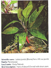
Mengkudu Akar